
A closer look
China's Grand Canal changes the scale at which a place becomes intelligible. A bridge in Hangzhou is not only a local landmark; it belongs to a history of connections between waterways, settlements and distant centres of power. The canal is best understood as a system developed and altered over time, not one enormous trench completed in a single moment. Its significance lies as much in movement and maintenance as in length.
This distinction matters when we encounter it through a photograph. Calm water and an old bridge can suggest a landscape outside history. Yet a canal is an intervention: water directed, banks shaped, passage negotiated and structures repeatedly cared for. The apparent stillness of a view conceals the work that allows it to function. To look well, we need to imagine relationships without pretending that we can recover every past life from the scenery.
A network, not a single building project
UNESCO's account of the Grand Canal describes sections originating from the fifth century BCE and a unified imperial communication system developed under the Sui in the seventh century CE. Subsequent dynasties changed and maintained it. By the thirteenth century, the network linked five major river basins through more than 2,000 kilometres of artificial waterways. Those figures describe a historical system, not a promise of one continuous visitor route today.
The difference between a river and a canal is therefore only the first question. The more revealing question is how artificial routes interacted with rivers and lakes. A connection can make movement possible, while a crossing of water systems can introduce risk. It is misleading to imagine engineering as the simple imposition of a line on an empty landscape. The landscape was active, and the line had to keep responding.
Read the canal as a set of negotiated relationships: north and south, settlement and food supply, controlled passage and unpredictable water. This is not an invitation to romanticize state power. It is a way to make infrastructure visible as a condition of everyday life. A capital's apparent permanence depends on activities taking place far beyond the monuments through which visitors usually recognize it.
Grain gives distance a practical meaning
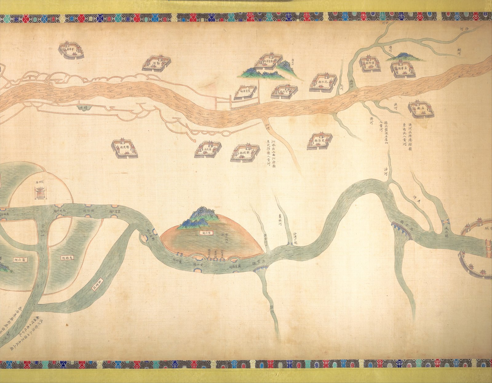
The Met's record for a Qing canal map links northbound grain transport with the problem of flooding. Provisioning and risk belong together. A route is not simply a space through which something moves; it is a relationship that must remain workable. This makes the canal an especially useful place to think about the effort hidden inside an ordinary meal.
Think of a bowl of rice not just as a finished meal but as the endpoint of a chain. Someone grew the grain; it had to be collected, moved and delivered. The historical canal gives geographical substance to that chain. This is an interpretive exercise rather than a reconstruction of one particular shipment. Its value is to reconnect the seemingly ordinary act of eating with the spatial organization that supports it.
The same exercise can change how we look at a waterfront. A bank is not only a pleasant edge between land and water. It can be an interface where movement changes form: from vessel to land, from passage to storage, from travel to exchange. Not every attractive building beside the canal was a warehouse, of course. Specific claims require specific evidence; the larger question helps us know what evidence to seek.
A painted map is not a satellite view
The Met dates the map to around the turn of the nineteenth century but its geographical content to 1737–1761. Object and represented moment are different questions. When did somebody make this? What period does it show? Separating those questions is a useful habit whenever a historical image seems to offer direct access to another time.
The map combines schematic routes with pictorial features. Rather than dismissing that mixture as imprecise, ask what it allows the viewer to recognize. Waterways and settlements become readable in relation to one another. A landmark can be made visually distinctive without obeying the uniform perspective of a modern aerial image. Different conventions answer different needs; they should not be judged solely by resemblance to the map on a phone.
Our small reproduction is an orientation to the object, not a substitute for its details. Open the museum's record and examine the enlarged image if you want to follow individual labels. This is also a useful companion to viewing a Chinese handscroll. The physical format encourages an experience of unfolding relationships rather than consuming the whole territory in one glance.
Begin locally in Hangzhou
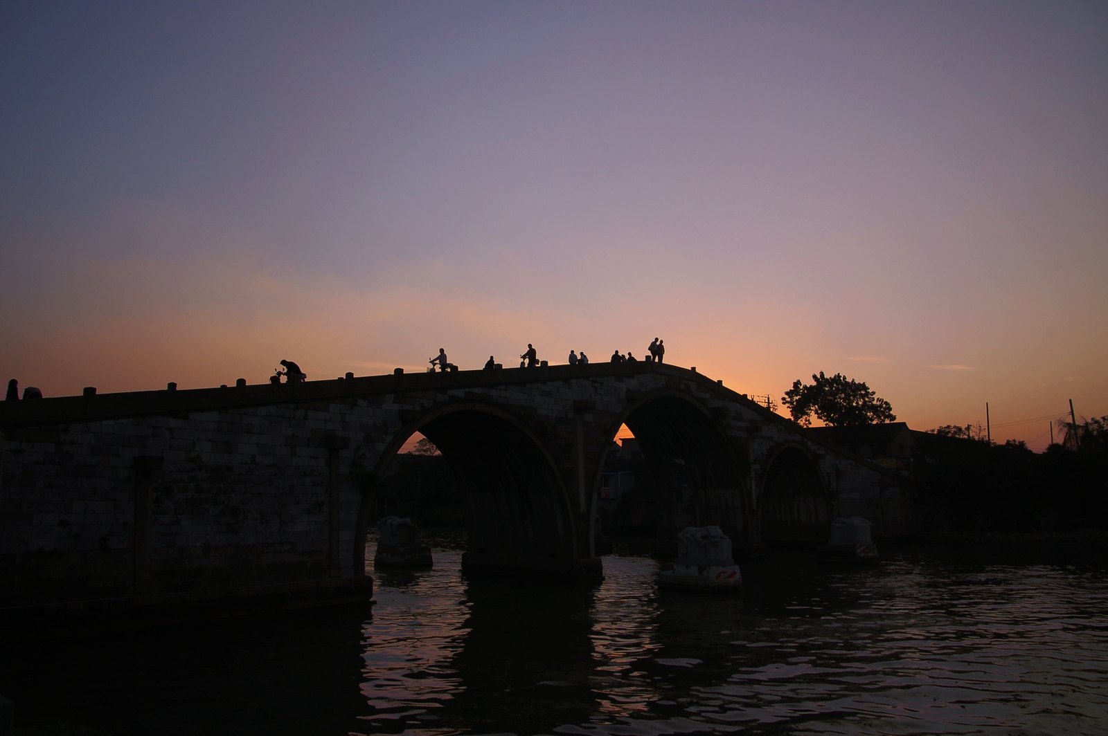
The Zhejiang account of Gongchen Bridge describes a three-arched stone bridge crossing the canal and places its original construction in 1631. The photograph here records the bridge in 2006, not its first appearance in the seventeenth century. Keeping the dates separate prevents an attractive image from silently becoming a claim that nothing has changed.
As a viewing exercise, trace the bridge in two directions. Across the water, it connects the banks; beneath its arches, it leaves room for movement along the water. Two kinds of passage meet without being identical. That is why a bridge can be so effective as an introduction to a larger system. Its shape makes the relationship between routes visible in a single structure.
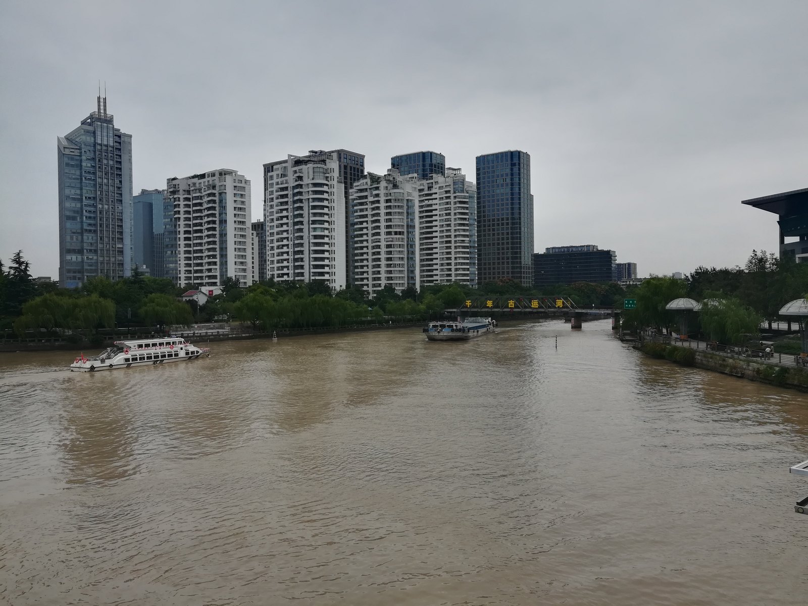
The second Hangzhou photograph, taken at Wulinmen in 2019, offers a different urban setting. Together these images resist the idea that there is one picturesque “canal look.” Neither supplies current information about access, schedules or navigation. They are dated observations of places. A visit requires up-to-date local information; understanding the images requires attention to what their captions actually establish.
Look for care as well as age
A living waterway creates an interesting tension for heritage. We may want visible age, yet functioning infrastructure requires intervention. UNESCO's assessment itself discusses the difficulty of interpreting sections changed through dredging, widening and rebuilding. A repaired bank is not automatically evidence of failed preservation, just as an old-looking surface is not automatically proof of authenticity.
For an attentive visitor, the most useful questions are concrete. What does this structure do? Which part is documented as historic? What has been repaired, and why? How does the waterway relate to the city around it? These questions leave room for both admiration and critical thought. They also resist reducing the canal either to an engineering superlative or to a background for photographs.
Compare this water-based reading of place with Suzhou's garden landscapes or Quanzhou's maritime connections. Each asks us to see a place through relationships rather than as an isolated destination. The Grand Canal makes one relationship especially clear: what looks local may depend on a geography that extends far beyond the frame.
Join the conversation
What did this make you notice?
What hidden transport route has shaped the city where you live?